 To view the Orem City 2018 General Plan, click on the link(s) below:
Orem City 2018 General Plan with 2023 Housing Amendment (Low Resolution)
Orem City 2018 General Plan (High Resolution)
Orem City 2018 General Plan (Lower Resolution)
The law requires that cities develop and adopt a general plan. A general plan is a comprehensive long-term plan for the physical development of the city. In a way, it is a “blueprint” for future development of the city. Because this plan deals with the entire city, it is often fairly general—which is why it’s called a general plan. The Orem Plan contains the following sections:
Introduction – This chapter explains the purpose of a general plan, lays out an outline of the Plan, and provides a history of Orem.
Land Use – This chapter offers strategies for developing land in a manner that complements existing uses. This chapter also addresses the interaction between commercial, residential, industrial, and other land uses, as reflected in the State Street Corridor Master Plan adopted in 2015 and various neighborhood level plans recently adopted.
Urban Design – This chapter reviews the adopted policies that impact the design of the urban landscape in Orem.
Housing – This chapter examines the existing conditions and future trends of Orem’s population, demographics, and housing stock. This chapter also includes strategies for maintaining and encouraging a variety of housing options within the community, including options for moderate income residents—as required by State law.
Economics – This chapter generates goals and strategies for attracting and maintaining beneficial economic activity in the City. This chapter references the Orem Economic Development Strategic Plan adopted in 2015.
Transportation – This chapter details the existing and future transportation needs of the City. This chapter references the Bike & Pedestrian Plan adopted in 2010 and the Transportation Master Plan adopted in 2015.
Parks and Recreation – This chapter presents the parks plan for the City as reflected in the Parks, Recreation, Trails, and Open Space Master Plan adopted in 2017.
Public Services – This chapter reviews the municipal services provided by Orem, including public works, the library, public safety, and other. Orem’s newly adopted impact fees are also explained.
Appendix – The appendix contains various supporting documents and maps, as well as the plans referenced in the various chapters.
 The Orem Bicycle and Pedestrian Plan was adopted in 2010 and represents a citizen driven plan to increase the walkability and bike-ability of Orem. The City of Orem has increased its investment of bicycle and pedestrian infrastructure in recent years. New bicycle lanes have been installed in conjunction with some road surfacing projects. Pedestrian sidewalks are typically continuous in neighborhoods and along most of the roadways. Traffic lights are generally equipped with pedestrian ramps and pedestrian signal heads, many of which also are pedestrian countdown signals. As new development and redevelopment occurs in the future, the city has an opportunity to continue and enhance the investment in bicycle and pedestrian infrastructure.
The vision of this plan is that Orem will eventually be one of the most bicycle and pedestrian friendly cities in the State of Utah, and will be rated a “Platinum” Bicycle Friendly Community by the League of American Bicyclists. Progress has been made as Orem was rated a “Bronze” Bicycle Friendly Community in 2018.
The plan outlines a path forward based on the following goals:
Implement a Complete Streets Policy
Complete a non-motorized transportation system network
Monitor the implementation of the Orem Bicycle and Pedestrian Plan
Reduce the vehicle miles traveled by single occupancy vehicles in the City of Orem
Integrate bicycling and walking into the transit system
Ensure citywide bicycle and pedestrian facilities are clean, safe, accessible
Implement comprehensive education and encouragement programs targeted at all populations in the City
Increase enforcement on City streets and bikeways
Provide safe and accessible routes for bicyclists and pedestrians of all ages and abilities.
To view the Orem Bicycle and Pedestrian Plan, click on the link below:
 The settlement of Orem is unique compared to most other Utah cities, in that it didn’t start out as a grid system, but rather, it grew up along the State Street Corridor. It started with homesteads, farms, and orchards, and by the mid-1900’s, had begun to transition to the primarily commercial corridor that exists today, which supports the 90,000 + Orem residents, and the surrounding region.
However, as the current buildings and infrastructure along State Street age, a new wave of development pressure is hitting the corridor, especially the demand for multi-family housing. The State Street Corridor Master Plan presents an opportunity to accommodate this development, while updating the face of State Street, and therefore the face of the City itself. It is the result of significant research, public open houses, online outreach, stakeholder and steering committee meetings, City Council discussion and testing of community inspired design and policy solutions.
This Plan is intended to be a road map for the residents of Orem to embrace and implement a family-friendly vision for the future of the State Street corridor – a common purpose to guide development and to galvanize the community. The public involvement process resulted in defining the following project vision, goals and design principles.
To view the State Street Corridor Master Plan, click on the link below:

The Orem Economic Development Strategic Plan was updated in 2022. Economic Development Strategic Plans provide a community with an opportunity to envision their future and formulate the appropriate steps to achieve that desired future. A solid plan is critical for a prosperous future, long-term economic viability, and a high-quality of life for residents. When done correctly, the economic development strategic planning process facilitates conversations between public and private leaders, residents, students, faith leaders, optimists, skeptics, and other key community stakeholders.
Following a structure outlined by the International Economic Development Council, the project team
developed an economic development strategic plan that provides:
• A realistic appraisal of available resources, constraints, and opportunities;
• A formulation of a clear mission and shared vision;
• The development of achievable and measurable goals;
• The formulation and implementation of project action plans to reach these goals and identify who will
champion them;
• The design of clear metrics of success.
View the Orem Economic Development Strategic Plan![]() Orem is a regional activity center, with a large concentration of retail, commercial, and institutional land uses that attract many visitors. This is great for the City’s local economy and provides jobs, nearby amenities, and sales tax dollars. However, this activity has a considerable impact on Orem’s infrastructure, particularly the roadway network.
Orem is a regional activity center, with a large concentration of retail, commercial, and institutional land uses that attract many visitors. This is great for the City’s local economy and provides jobs, nearby amenities, and sales tax dollars. However, this activity has a considerable impact on Orem’s infrastructure, particularly the roadway network.
Some residents mistakenly attribute the traffic on State Street and other City roads to Orem’s population growth. Although population growth in Orem has been positive, it is not nearly as great as the growth in nearby cities and in Utah County as a whole. As the County continues to grow, Orem will experience increased demand on its roadway network. In 2040, it is expected that an average of 74% of vehicle traffic will be from visitors who live outside of the City.
Due to growth within the City and the large growth throughout the County, a comprehensive transportation plan was adopted in 2015. This plan incorporated the goals of the City regarding the transportation systems within our jurisdiction as well as those regional facilities maintained by UDOT, UTA, Utah County, and neighboring communities.
The Orem Transportation Master Plan can be viewed using the following link:
The City of Orem recognizes the need to provide parks and open space to enhance the quality of life for all Orem residents. There are numerous health benefits associated with access to parks and opens space.
Access to these types of spaces has been associated with better perceived general health, reduced stress levels, reduced depression, and other benefits. According to research, people who use public open spaces are three times more likely to achieve the recommended levels of physical activity.
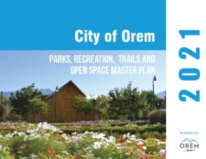 The City of Orem Parks, Recreation, Trails, and Open Space Master Plan (2016-2026) builds upon previous studies and plans and provides a comprehensive needs analysis and direction for the effective and equitable planning for parks, recreation, and trails development during the 10-year planning horizon and beyond.
The plan addresses existing conditions, priorities, levels of service and other considerations of a comprehensive parks, recreation and trail system. The plan also analyzes and assesses the full range of facilities required to meet future needs, and presents goals, objectives and policies that reflect the City’s commitment to improving the quality of life for residents.
To view the City of Orem Parks, Recreation, Trails, and Open Space Master Plan, click on the link below:
City of Orem Parks, Recreation, Trails and Open Space Master Plan
 Street connectivity (or permeability) refers to the directness of links and the density of connections in a transportation network. A highly permeable network has many short links, numerous intersections, and minimal dead-ends.
The State Street Master Plan recommended adding several street connections on or near State street. According to the plan, adding more street connections will help create a smaller, more walkable block pattern; it will help establish a grid network between Orem Boulevard and State Street improving vehicular and pedestrian circulation; and it will create additional opportunities for building frontage on streets that are more pedestrian friendly than State Street. In addition, increased connectivity will help lower speeds and reduce accident severity, provide greater emergency vehicle access, provide improved utility connections, and better accommodate future transit use.
When development or redevelopment occurs on properties that intersect a proposed street connection, “corridor preservation” will be required on preliminary plats and site plans subject to the requirements of Utah Code Sections 72-5-401 through 72-5-406 inclusive.
The following maps depict the proposed street connections in greater detail:
 The purpose of this study is to understand the current challenges in the housing market and examine the options available to provide a reasonable opportunity for a variety of housing, including moderate income housing. Strategies that will encourage affordable housing in Orem are recommended, and it is intended that this study will be the basis for ongoing discussions by the City Council to develop a moderate-income housing plan and ensure that Orem remains a City where everyone is welcome.
Until recently, the Utah housing market provided more new housing units than new households–in other words, the supply of housing kept up with the demand. Since 2011 this has not been the case. The reasons for this are varied, but chief among them are land constraints, restrictive zoning ordinances, and rising construction costs. While these are national trends, Utah has been disproportionately impacted due to our larger than average families and our high rate of population growth.
Compared to the Utah County and State average, households in Orem that make roughly 80% of the household area median income are more likely to find housing that does not exceed 30% of their income (the general measure of affordability). This is due in large part to Orem’s long history of zoning for a range of housing types, many of which offer lower housing costs. Housing options in Orem include smaller single-family homes on smaller lots, as well as accessory apartments, duplexes, triplexes, quadplexes, and larger multifamily housing.
Despite this, affordability is still an issue in Orem. To allow for strategic growth and help increase the supply of housing, the Orem City Council has adopted the City Center District mixed-use zone and is considering additional Districts along State Street. As well, Orem will be exploring other strategies to increase the supply of affordable housing in the City, as outlined in this study. Ultimately, Orem recognizes that this a regional issue, and the City is committed to being part a regional response.
To view the Orem Moderate Income Housing Study, click on the link below:
Orem Moderate-Income Housing Study


 In 2017, the U.S. Environmental Protection Agency (EPA) selected the City of Orem as a Brownfield Area-Wide Plan (AWP) grant recipient. The AWP program assists communities in responding to local brownfields challenges, particularly where multiple brownfield sites are in close proximity, connected by infrastructure, and limit the economic, environmental and social prosperity of their surroundings, areas such as the Geneva Road corridor.
The Imagine Orem: Geneva Road plan focuses on developing a strategy for addressing brownfields in the Geneva Road corridor. This historic industrial area continues to be an important source of employment and tax revenue for the City. However, it also contains many vacant and blighted brownfield sites, owing to commercial and industrial uses historically located in the community.
Purpose of the Plan
Orem is bounded to the east by mountains, to the west by Utah Lake, and to the north and south by neighboring communities. With very little remaining undeveloped land, Orem has few places left to grow. Future development will depend on strategic infill of the City’s existing sites, including underutilized brownfield and industrial properties in the Geneva Road corridor.
It is critical for the City to engage in a planning process now to ensure that the redevelopment of Geneva Road’s valuable industrial properties is reflective of the community’s vision for the area and will provide robust community benefits. While it is anticipated that much of the Geneva Road corridor will remain industrial in nature, there are opportunities to include new commercial and mixed-use properties to compliment the new development that is occurring nearby.
To view the Geneva Road Area-Wide Plan click on the link below:
Maps and Graphics
Adopted Neighborhood Plans
1. Canyon View, Orchard, & Cascade Neighborhood Plan
2. Orem North & Sharon Park Neighborhood Plan
3. Northridge, Heatheridge, & Windsor Neighborhood Plan
4. Aspen & Timpview Neighborhood Plan
5. Geneva Heights, Orem Park, & Suncrest Neighborhood Plange
6. Orem, Sharon, & Hillcrest Neighborhood Plan
7. Stonewood & Lakeridge Neighborhood Plan
8. Sunset Heights East & West Neighborhood Plan
9. Lakeview and Cherry Hill Neighborhood Plan
What is a neighborhood plan?
The law requires that cities develop and adopt a general plan. A general plan is a comprehensive long-term plan for the physical development of the city. In a way, it is a “blueprint” for the future development of the city (the Orem City General Plan can be found here). Because this plan deals with the entire city, it is often fairly general—which is why it’s called a general plan.
A few years ago, Orem City decided to develop more specific neighborhood plans. The City’s neighborhoods were organized into 9 groups. A plan will be developed for each neighborhood group. Each plan will be developed under the direction of city staff, will be in harmony with the City’s general plan, and will rely on representative participation from residents and businesses located in the neighborhoods.
How long does it take to develop a plan?
Each neighborhood plan was developed and completed over a several-month process. Typically, three public meetings were held: a kick-off meeting, a progress meeting, and a final meeting to present a draft of the plan. In the beginning, residents from the neighborhoods were asked to be on a neighborhood advisory committee made up of neighborhood representatives—residents and local business owners. In between the public meetings, several smaller meetings are held with the neighborhood advisory committees, developing goals, and vision statements and learning about city departments and their roles in the neighborhoods. Once a plan has been created, it will be presented to the Orem Planning Commission and the Orem City Council for adoption as an appendix to the general plan. It is anticipated that each neighborhood plan will be updated every five years.
What is the main purpose of the plan?
Each neighborhood plan is structured the same, with city-level information and specific information around five main areas comprising the chapters of each plan. The primary purpose of the plans is to communicate the major goals, objectives, and concerns of the neighborhood to city leaders—both elected officials and staff. When leaders are making a decision that affects a particular neighborhood in Orem, they will have a plan to refer to that provides a representative vision of what the neighborhood wants.
When was my neighborhood plan be completed or updated?

In 2020, the last neighborhood plans were completed and adopted. The next phase of the Neighborhood Plans is to focus on the goals and objectives that were developed as part of each neighborhood plan over the five-year process (see the tab below for more details). It is anticipated at this time that future neighborhood plan updates will be completed in the same order. The map above neighborhood plan groups and the order of completion. The order is as follows:
1. Canyon View, Orchard, & Cascade Neighborhood Plan
2. Orem North & Sharon Park Neighborhood Plan
3. Northridge, Heatheridge, & Windsor Neighborhood Plan
4. Aspen & Timpview Neighborhood Plan
5. Geneva Heights, Orem Park, & Suncrest Neighborhood Plan
6. Orem, Sharon, & Hillcrest Neighborhood Plan
7. Stonewood & Lakeridge Neighborhood Plan
8. Sunset Heights East & West Neighborhood Plan
9. Lakeview & Cherry Hill Neighborhood Plan